home > hungary > SZALLAS
SZALLAS hungary map informations about the city countries cities
countries cities SZALLAS hungary map informations about the city
informations about city SZALLAS hungary
city SZALLAS country hungary latitude is 46.4833city SZALLAS country hungary longitude is 18.4000
map SZALLAS hungary
city SZALLAS map country hungaryroad map city SZALLAS hungary
road map city SZALLAS hungaryroad map SZALLAS
weather city SZALLAS hungary
weather forecast city SZALLAS hungaryweather SZALLAS
how to call hungary
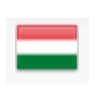
call to hungary with the international hungary country phone code 36hungaryflag
country hungary flag
informations about hungary
hungary capital : budapesthungary languages : hungarian
hungary currency : forint HUF
hungary area : 93 030 km2
hungary population : 9 938 000
hungary iso code alpha 2 : HU
hungary iso code alpha 3 : HUN
home > hungary > SZALLAS
contact